
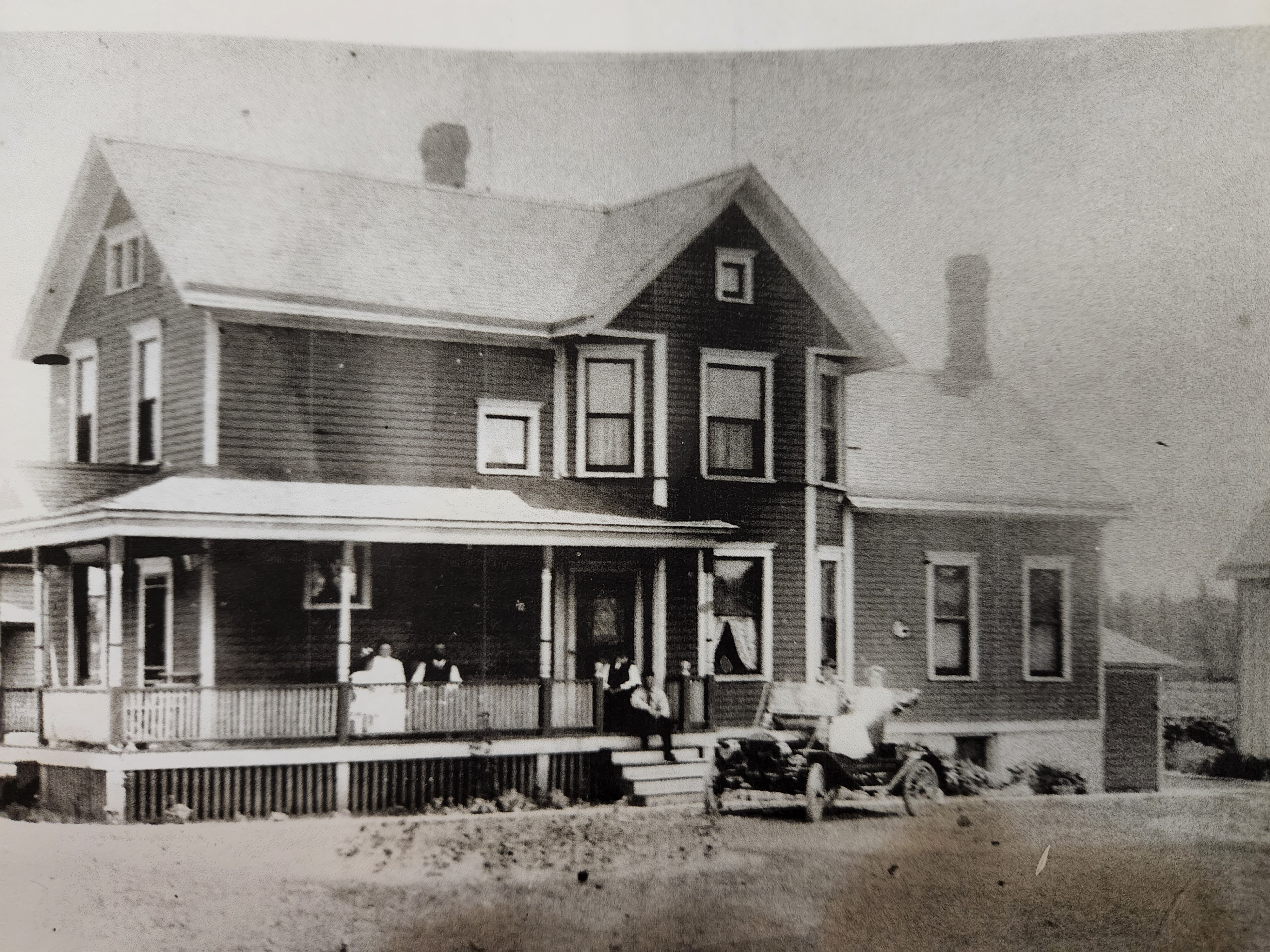
We all take many things for granted in our lives. We take for granted that many of us own a car or take public transportion to travel to work and to run our errands each day. Our ancestors up until around 1900 and 1920 primarily used horses and buggies to get around town. In reviewing several photos of our Schlicks second generation in American we see photos of their automobiles pulled up behind them as if they are part of the family just like the family dog.

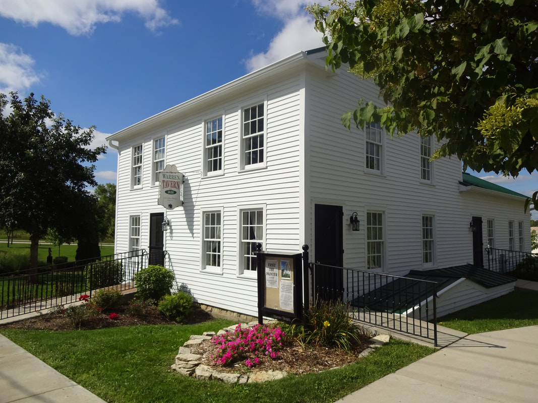
Roads were important. Researching the development of roadways is facinating. Most major roads we travel today in Winfield Township began as Native American paths radiating out of the City of Chicago to the shores of Lake Michigan: Ogden Ave (Illinois Route 34) and Butterfield Road (Illinois Route 56) are but two examples. One of the main road traveled by the Schlicks and Daleidens was Winfield Road. In my research this was known as the Winfield to Naperville Road. It was used as a mail route and stage coach route between the two cities of Winfield and Naperville prior to the building of the Burlington Northern Railroad route from Chicago to Naperville in 1864. The coach would make stops in Warrenville and at Col. Warren’s Tavern.
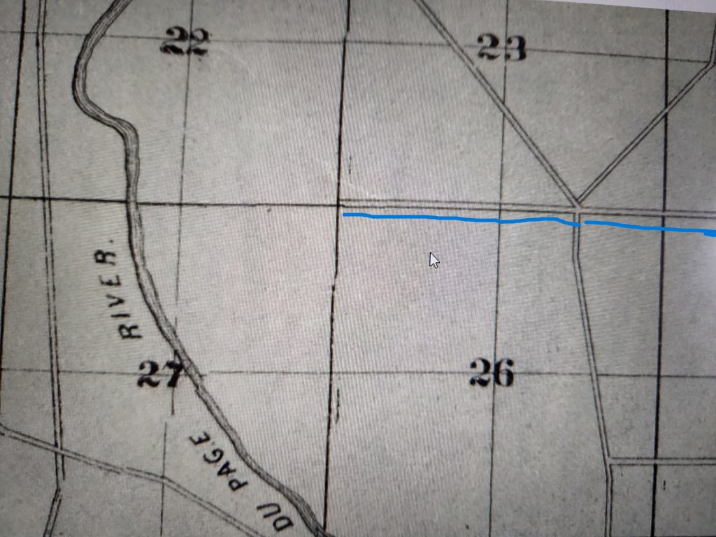
Mack Road (shown in blue above) was one of the original east-west roadways providing area farmers access to their farms and the Village of Winfield to the north and Warrenville and Naperville to the south. Mack Rd. intersected Winfield Road just north of creek that ran through Winfield Road.
In her 1982 book titled In and Around Historic Warrenville Leone Schmidt, the City Historian for Warrenville Illinois, writes about the history of Mack Road. (This Excerpt is taken from pages 116 -117 of this book):
“THE ROAD BORDERING THE NORTHERN edge of Mack’s [Edward Packer Mack] land grant was not built in a day — not even hundreds of days. First surveyed in the summer of 1851 upon application of 27 local farmers, the road was laid out beginning at Winfield Road westward to [the current Illinois] Route 59, but for some reason construction stopped at Mack’s house. For 26 years, Mack had to travel east to Winfield Road no matter what direction he wanted to take. At last, in 1877 [Note: This is circa one decade after Michael purchase the adjourning farm located to the east of Mack’s farm.] a group of farmers, began an attempt to get the western section of the road completed.
This time the stumbling block was Mack’s neice, Sarah Maria Mather. She objected — strenously — to the road being routed through the 14-acre peice of her father’s land [Israel Mather] she had inherited after his death in 1869. Through several months of hearings and appeals before the commissioners and before a jury (she was represented by Elbert Gary and the road commissioners by William Manning) she remained adamant, refusing the $400 she had been offered for damages.
How was a bunch of farmers to deal with a stubborn worman? Uncle Ed found a way. He and his good neighbor, James Fairbanks, whose land lay at the western end of the proposed road, negotiated an argreement with the road supervisor. These two men would cut the timber, clear the surface, grade and build the road and the ford across the river [The West Branch of the DuPage River], and keep the road in proper repair for one year — all at their own expense; and Sarah Mather did sign the release of damages in the amount of $400, in March 1878.
The farmers put up with fording the river for about 15 years; then in 1893 they put pressure on the [Winfield] township road commissioners to build the bridge. The township could not afford the cost, they said, but maybe they would “go halves.”
The county and township agreed to undertake the project jointly, going ahead with plans for a bridge just like the one which had been constructed at Gary’s Mill [Located north of Mack Road], with completion date of October 15, 1893. The bill for a wrought-iron truss bridge with oak flooring and a wall of Naperville [lime]stone, with approached, was estimated to come to $ 2,200. Their estimate was way off, however. The contracts awarded to R.D. Wheaton for the superstructure and Hartman Brothers for the abutments totaled only $1,692.

THE IRON BRIDGE [See photo below] WAS replaced in 1954 [68 years old in 2022 !] with a pre-cast concrete bridge built by the Advance Construction Company of Chicago. . . . “
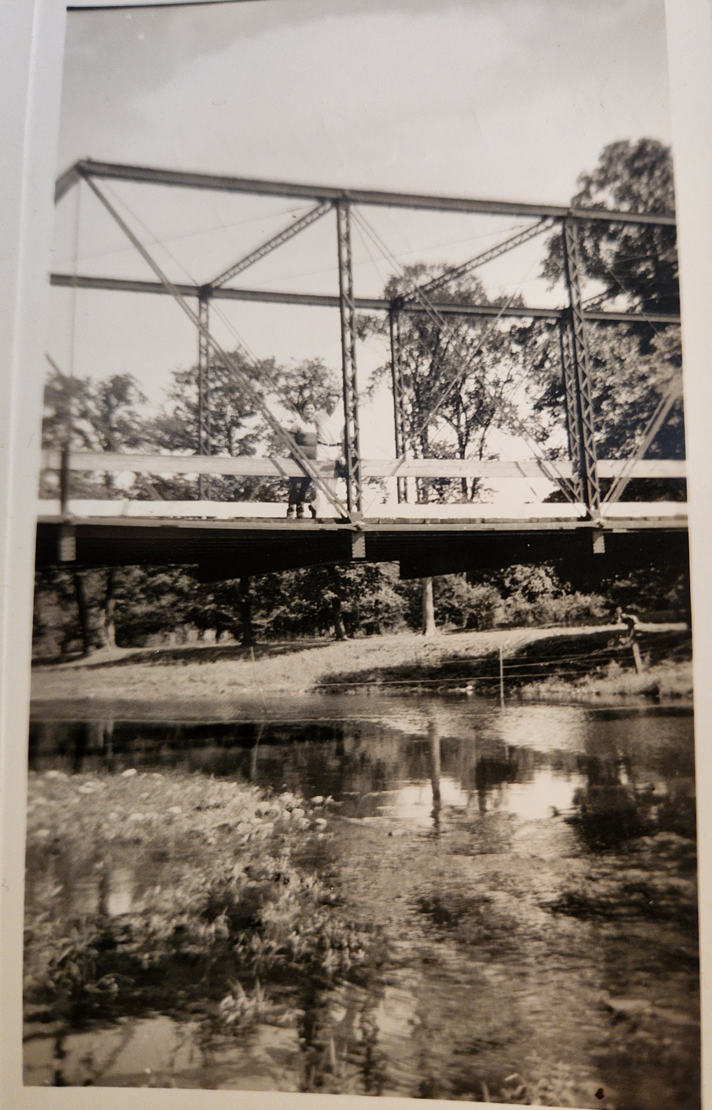
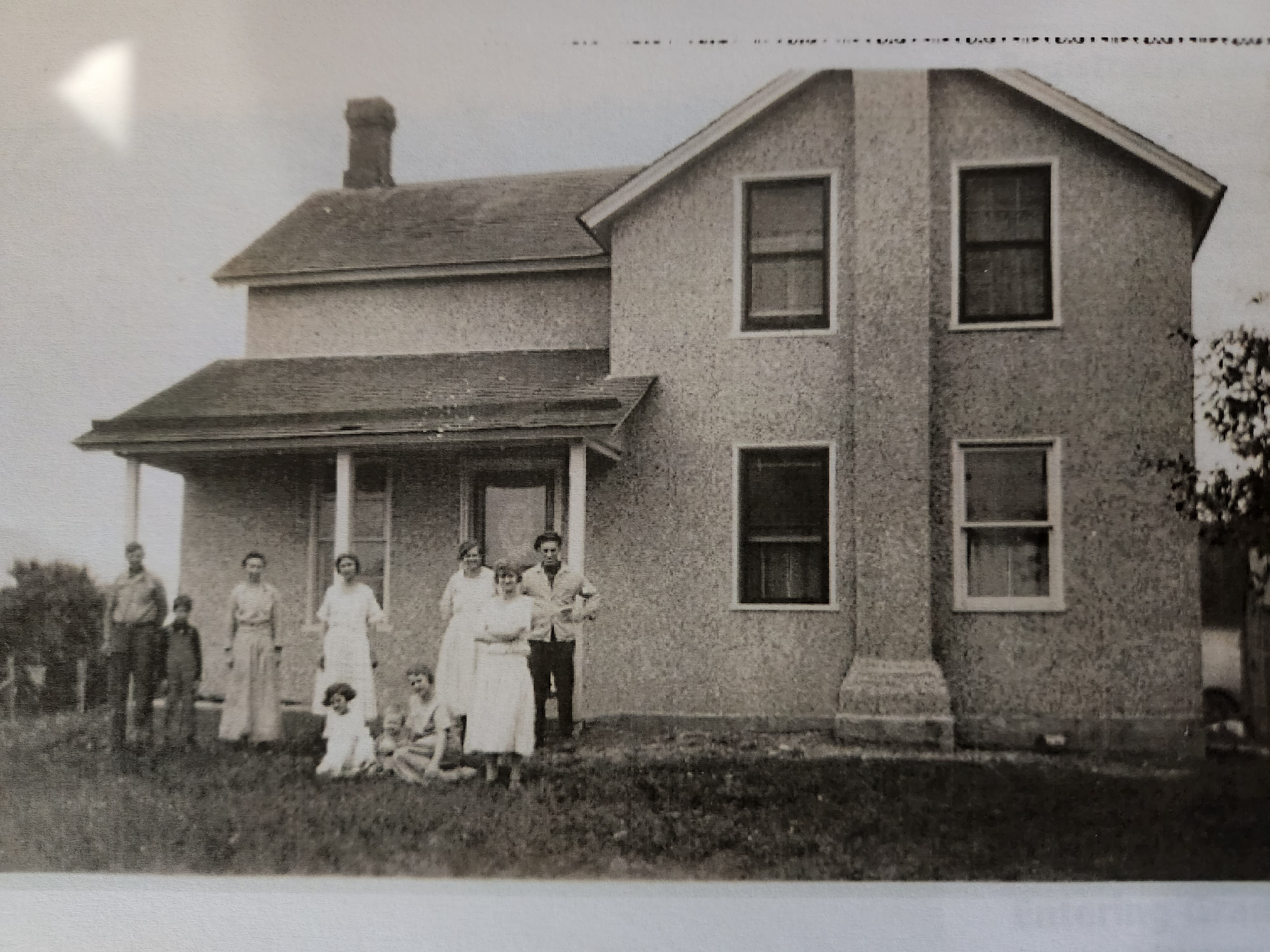
(Photo: Frank J. and Mae C. Schlick Estate Archive).

